My adventure started when I was re-reading my mountaineering book in order to prepare for helping a friend teach a basic moutianeering class. "Navigation is easy," it says. It even goes further to say "Navigation is fun." As I read these words, and subsequent pages outlining how to find out where you are and where you're going, I decided that today was the day. This was the day that I would find my way from my house to the logging road in back of it, with no difficulties, no getting lost (as I have the numerous other times I've tried it, dragging along friends and dogs along the way), just pure and simple, walk up the hill, make the appropriate turns, and Voila! The road would be before me. Then, I did what I've never done before, but what the book suggests that one do. I prepared. Prepare!!! Eek! It occurred to me to look at just how far I should have to walk before making various turns, and, it turned out that everything was really quite close. It shouldn't take hours, it should take minutes. I set out, I constantly checked my time, my altitude (how high above sea level - I have an altimeter that does that for me), my direction, and the map. And, rather than heading for the road, which juts out just a short distance, I headed for the much longer, and "can't miss" landmark of the power lines that the road crosses. And, Voila! I did, indeed, make it! It took me about 50 minutes. I'm thinking that it should take about 30 minutes if I were to do the same thing, again, without checking the map every 5 minutes. . .
At this point, I could head back on the road, and get back in about 10 to 15 minutes, or, I could head back, through the woods, and see if I could repeat the success in the other direction. I decided to repeat my success, except that I knew my way, now, and so didn't need to look at the map, and I decided that I'd stay on the top of the ridge, where it was easier to walk. It was looking as though I'd be back at my house in about 30 minutes, except, that all of a sudden, nothing looked familiar, well, actually, it did look familiar - I saw the clear-cut area, I'd seen years ago, when Hoa and I had this same adventure, and he threatened to buy me a GPS. But this time, I was not going to cut through the properties, as we did back then, I was going to find my way back, so out came the map, and compass, and I saw that I managed to swing too far west, so I did my course correction, which meant going over a couple of ridges (reminiscent of my St. Helens climb many years ago, only there, they were MUCH bigger ridges), and soon I was on MY ridge, and heading down into my backyard. My error was that while I was on the top of the ridge, I didn’t notice my "branching off" ridge. Dang, 50 minutes to return, too. However, the 50 minutes each way still seemed tons better than my previous attempts. I finally conquered my back yard! (I'll be even happier when I can repeat it in about 30 minutes, each way, without deviations. . ., but I'll settle for having done it, according to the map, for now.)
leora
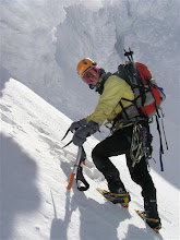
P.s. I still don't have the last Turkey write-up on my blog (pictures take so long to upload over dialup. . .). As soon as I get a picture from my week of ice-climbing in Ouray, Colorado, I should be posting that. That was FUN!
I do have 2 pictures from my parent's 50th Wedding Anniversary party this January that I should show you (click to get large image):
Our family + Leslie's (my brother's) girlfriend, Sherri

And a cute one of my folks: