We
did it!!! Just a little over a year ago, when we completed 49 out of the
50 highest points in each state, I did a write-up: 49
continental state highest points complete. We still had the highest
point of one last state to attain: Hawai’i! And, at last, we did it!
Two
days ago, we first attained it when the grandson of my now former neighbor,
Cathy, drove us nearly to the top, and we all sauntered over to the true
summit. Knowing how this would engender ridicule and scorn from our
hiking and climbing buddies, we then went back, yesterday, and hiked the 6-plus
miles (9.6km) and 4,800 ft (1463 meters) to the summit from the Visitor Center. The weather,
yesterday, wasn’t as ideal as the previous day, so we couldn’t see as
much. Here are the two “couple” summit photos from each day. This
first one is from September 6th (when we had Mark to take
our photo!) – Mauna Loa is the mountain in the distance:


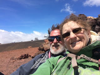
And
then this one from September 7th – since we arrived later in the
day, we had to change the background, so that the sun’s direction would be more
favorable to the photo, so you can see some of the many buildings that litter the summit area (besides, Mauna Loa wasn’t
visible, due to the clouds):

And,
as many of you know, I’ve been using our state highest point achievements to
bring awareness to Juvenile Myositis (a sometimes fatal autoimmune disease
affecting children) by taking a photo of a Cure JM banner supplied years ago by
a friend whose son had the disease and has since passed away due to it.
Photos with the banner at all of the highpoints can be seen here
(this is public, you don’t have to belong to Facebook to see it). Here is
the Hawai’i Cure JM photo:


A
fascinating thing about this state high point is the myriad of antennas, arrays
of antennas, telescopes, and observatories that are on the top of this
mountain. These buildings are all HUGE. The mountain is also
HUGE! Note the red color:

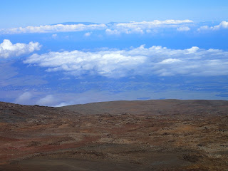
From
the summit (on the 6th, when it was clearer!), we could see
Maui! (I’m assuming that it’s actually the top of Haleakala’s crater):

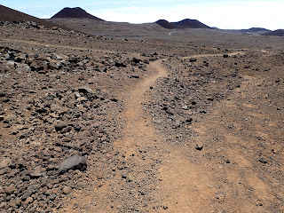
The
following is typical scenery for the whole top 1000 ft or so of the mountain:


This
was near Lake Waiau at 13,020ft, one of the highest lakes in the US – what I
found fascinating is that there was still flora up here:


I’m
including this photo because it shows some of the trail we took to the
summit. In the distance, you can see the road to the summit:

Almost
all of the signs on the mountain have these holes in them – presumably so that
the wind doesn’t blow them over:

May
you succeed in your long term goals/projects!
Leora